On this page
- Is the lake saltier than the sea?
- What does it mean that the water has layers?
- What are the reefs in the lake?
- How did the eruption of Tambora affect it?
- Can you swim in it?
- Where does the lake sit, and what protects it?
- What should you take from this before you visit?
- What else do visitors wonder about the lake?
- Which sources support this page?
- How do I reach the desk?
By Sumbawa Liveaboard Editorial Desk
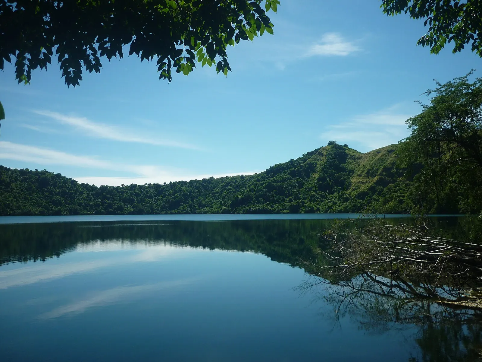
Yes, but not in the way brochures suggest. A hydrochemical study describes Satonda's lake as sea-linked and mildly alkaline, and its encyclopedia entry reports an upper layer with less salt than seawater. We have found nothing that supports the word hypersaline, which some operators use. Think of a quasi-marine lake, not a natural brine.
Is the lake saltier than the sea?
For the water you can see, no. The island's encyclopedia entry says the upper layer, 22.8 m thick, is oxygenated and, compared with seawater, less saline but more alkaline. The hydrochemical study calls the lake sea-linked and mildly alkaline, and describes today's conditions as slightly alkaline and quasi-marine. Neither source describes anything close to a hypersaline lake.
One limit applies: the comparison covers the upper layer only, so for the deeper water go to the study itself. Sellers use three different words for the same lake: Liveaboard Indonesia says hypersaline, Neptune Scuba Diving says saltier than the sea, and Dive The World says fresh water. None of those pages cites a measurement.
The muddle comes from sales copy. Some operators call the lake hypersaline, others simply a saltwater lake. Those phrases are easy to repeat and hard to trace. Here is how the common descriptions compare with what the sources support.
| What you may read | Where it comes from | What the sources support |
|---|---|---|
| "Hypersaline" | Some operator pages | Not supported by the study or the encyclopedia entry |
| "A saltwater lake" | Some operator pages | Too simple: quasi-marine, with an upper layer less saline than the sea |
| "Less saline than seawater" | Encyclopedia entry | Supported for the upper layer |
| "Mildly alkaline" | Hydrochemical study | Supported |
| "A tsunami filled the crater with seawater" | Operator storytelling | Unconfirmed; see the Tambora section below |
What does it mean that the water has layers?
The study calls the lake stratified. In plain terms, the water sits in layers instead of mixing freely from top to bottom. The upper layer is the one with oxygen and the one the salinity comparison describes.
The shape of the basin makes that easier to picture. The encyclopedia entry describes two craters that intersect, one 39 m deep and the other 69 m. An upper layer of 22.8 m is shallower than both, so each crater holds water beneath it. Anyone standing on the shore is looking at that top layer and has no way of judging from the surface what lies under it.
If a guide gives you a confident explanation of why the layers form, enjoy it as a guide's explanation.
What are the reefs in the lake?
They are calcareous reefs, meaning hard structures made of calcium carbonate, and the study names them as cyanobacterial and red algal. The encyclopedia entry says they occur at 13 sites around the lake. So set aside the image of coral gardens. These are built by very different organisms, and their interest is scientific more than scenic.
Very little else lives alongside them. The same entry calls the lake's fauna extremely poor in species, and the study uses the term species-poor. That thin life is what separates the lake from the sea reef just outside the crater, which our guide to a Satonda stop covers for divers and snorkellers. Treat the lake reefs as you would any fragile structure: leave them alone.
How did the eruption of Tambora affect it?
The study reconstructs 4,000 years of the lake's history and discusses how the 1815 eruption influenced it. Its sequence runs in three stages:
- Initially fresh water.
- A highly alkaline phase.
- Today's slightly alkaline, quasi-marine conditions.
So the lake has not always been salty, and its present chemistry is the latest phase of a long change. The study is the place to read how large a part the eruption played.
The eruption itself is well documented. The encyclopedia entry for Mount Tambora ranks it VEI-7, the largest eruption on record, and ties the "Year Without a Summer" of 1816 to it. For what you can see of the volcano from the water, read Mount Tambora from a liveaboard.
You may also hear that a tsunami from 1815 filled the crater with seawater. It makes a good story on deck, but it comes only from operators, whereas the hydrochemical study treats the eruption's influence on the lake's chemistry.
Can you swim in it?
We have not found an official source or a park rule saying that swimming in the lake is allowed or safe. Mild chemistry does not amount to a safety assessment, and a photograph of someone in the water does not amount to permission. Some programmes do schedule it: Sumbawa Tour's three-day page sets aside 10:25 to 11:00 for swimming in the lake, and Neptune writes of a swim in unusually buoyant water. A seller's timetable is not a rule either.
If swimming matters to you, put the question to the operator before you travel, in writing: is it part of the programme, who allows it, and is anyone supervising? Then check the reply against your insurance wording. Australia's travel advice warns against assuming that a policy covers adventure or high-risk activities, a caution that applies well beyond this lake.
Where does the lake sit, and what protects it?
The lake sits inside a small volcanic island. Wikipedia gives Satonda about 3 by 2 km, in Pekat District of Dompu Regency, less than 30 km north-west of Tambora, so keep that closeness in mind when the 1815 eruption comes up. The island also falls within Moyo Satonda National Park, established under a 2022 ministerial decree according to the West Nusa Tenggara provincial government. One sailing operator, Sea Trek, adds a human note: residents of Nangamiro village tie a small stone or a piece of coral to wishing trees at the lake. Treat those trees as you would the lake reefs, and leave them alone.
What should you take from this before you visit?
Three things are worth carrying with you. First, do not plan around buoyancy or a novelty float, since the top of the lake is less saline than the sea you just left. Second, go for the setting and the science, and save your marine life expectations for the reef outside. Third, when an itinerary uses a dramatic adjective for the lake, read it as marketing unless the operator can show you where it came from.
In the published itineraries, the lake appears as one line in a longer trip, and the chemistry will not change what you see on a short visit. What does change your day is whether the boat lands guests at all, and how long it allows ashore. Those are questions for the operator, listed on the Satonda guide linked above.
What else do visitors wonder about the lake?
Is Satonda lake hypersaline?
Not on the published evidence: the upper layer is reported as less saline than seawater, and we have no figure for deeper water.
Is the lake connected to the sea?
Yes, in the study's description, which calls the lake sea-linked and describes today's conditions as quasi-marine.
Did a tsunami fill the crater with seawater?
Not that the study says. The story comes from operators, while the study discusses the eruption's influence on the lake's chemistry.
Is there much life in the lake?
No. The encyclopedia entry calls the lake's fauna extremely poor in species. The reefs built by cyanobacteria and red algae are what the study singles out.
Has the lake always been salty?
No. The study reconstructs a lake that began as fresh water, passed through a highly alkaline phase and reached its current quasi-marine state.
Which sources support this page?
- Satonda Crater Lake hydrogeochemistry and biocarbonates study (ResearchGate)
- Satonda Island, encyclopedia entry (Wikipedia)
- Mount Tambora, encyclopedia entry (Wikipedia)
- Indonesia travel advice, Australian Government Smartraveller
- West Nusa Tenggara provincial government: park designation notice
- Seatrek Bali: Satonda Lake
- Liveaboard Indonesia: Sumbawa
- Neptune Scuba Diving: Sumbawa liveaboard crossing guide
- Dive The World: Sumbawa diving guide
- Sumbawa Tour: Liveaboard Tour 3 Days 2 Nights
How do I reach the desk?
If an operator has told you something about the lake that conflicts with this page, send us the wording on WhatsApp 6281139414563 or at bd@juaraholding.com.
Send the desk your route, dates, and group size. The desk replies in writing.
Ask the desk on WhatsApp bd@juaraholding.com